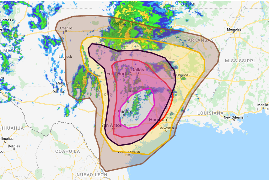
Central Texas is Under the Gun for Large Hail and Tornados Monday, March 21, 2022
March 21, 2022 - Hail, HailWATCHA large low pressure center is rolling out of the Southwest United States and into west Texas today, bringing the chance for large hail and a few possibly large tornados this afternoon and evening. The combination of upper level energy and surface features like dew points near 70 degrees will make for an extremely buoyant atmosphere for strong lifting and rotation. If you live in Austin, College Station, Bryan and even cities on the edge of the instability like Houston and Dallas, be weather-aware today!
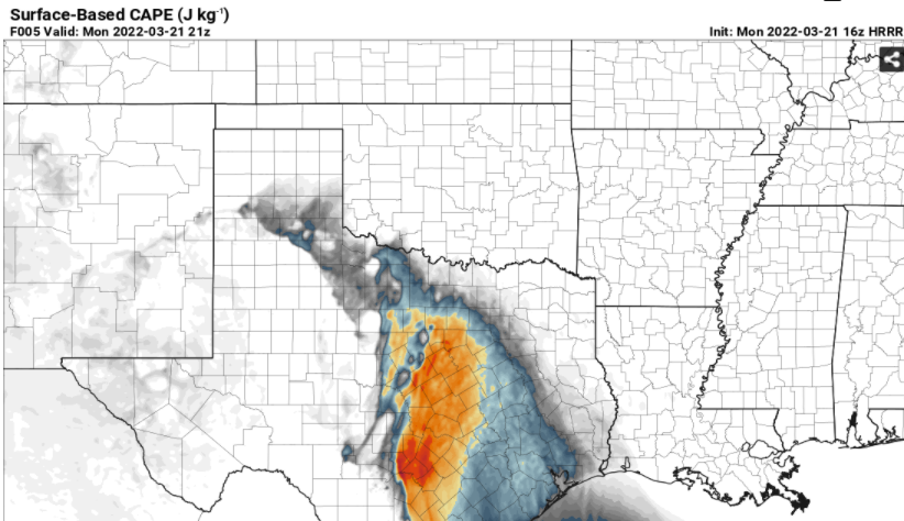
Here are a couple images to show the potential with the bullseye on central Texas for the most damaging storm potential. The second image shows the CAPE (Convective Available Potential Energy) for this afternoon and early evening approaching 3,000, plenty of energy waiting to be triggered as the energy arrives.